Lake Mead and Hoover Dam
From our starting point in Las Vegas, it's about 30 miles to Lake Mead National
Recreation Area. The lake was formed by the waters of the Colorado River which are
held back by Hoover Dam. It sits on the border between Arizona and Nevada. Due to
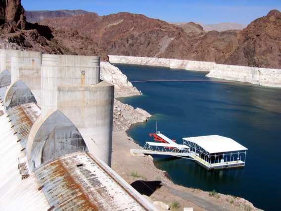
recent drought conditions, the water in Lake Mead is pretty low, but it's still
open for recreational boating and bathing.
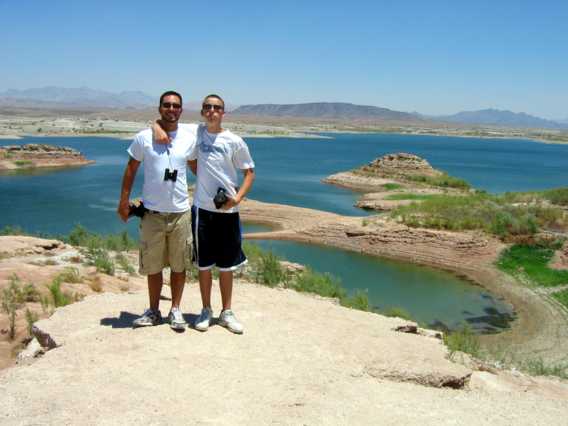
Below, Jesse and Matthew stand on the edge of a hill, with Lake Mead as the backdrop.
A few miles down the road from that spot, we meet up with U.S. 93, which crosses the top of Hoover Dam. There is a multilevel parking garage and visitor's center on the Nevada side of the dam.
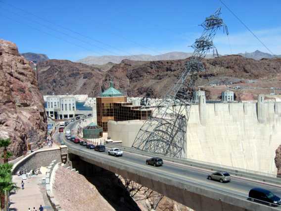
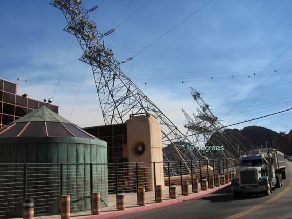
Aside from creating Lake Mead, Hoover Dam is a hydroelectric power plant, generating power for Arizona, Nevada and California. The inclined electrical tower in the photo above & below is carrying some of the power out from the transformers below, in Black Canyon.
I've highlighted a large circular thermometer on the side of the visitor's center. It reads 115 degrees.....but it's a DRY heat. HAH! Also in the photos below you can see cables going across the canyon.
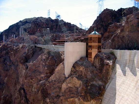
The cables which span the canyon are part of a construction cableway crane system. A major highway project is underway, which when completed in 2008, will reroute the U.S. 93 traffic over a new 2000 foot bridge, just south of the dam. The pylons on the Nevada side of the canyon, as well as the concrete support columns for the bridge can be seen top left and center in the picture above. The 2 structures in the center of the photo which seem to rise up out of the canyon comprise the recently built visitor's center.
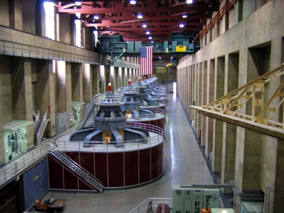
Above are the 8 main turbines on the Nevada side of the complex, deep within Black Canyon. On our visit, only 7 of the 8 are running, as indicated by the light on top of each generating unit. There are 9 more on the Arizona side.
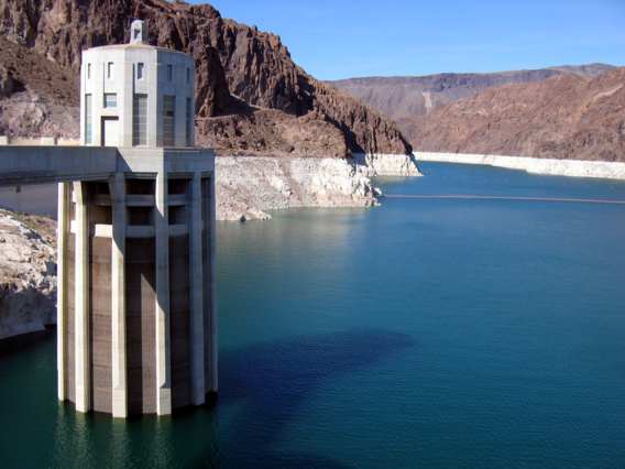
Water from Lake Mead enters through 4 intake towers, 2 on the Arizona side, 2 on the Nevada side. The one below is on the NV side, and you can see by the stains on the surrounding rocks, the water level is very low.
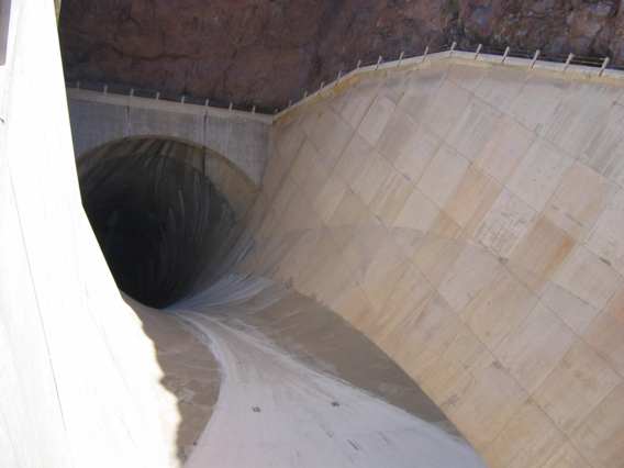
Water would never run over the top of the dam. If the level of Lake Mead ever exceeded normal levels, there are spillways on each side of the dam, which are 27 feet below the top of the dam. There'd have to be a 100 foot rise from today's levels in order for water to crest over the spillway. Below, one of these spillways, and the 50 foot diameter tunnel built to take the water through the canyon and out below the dam.
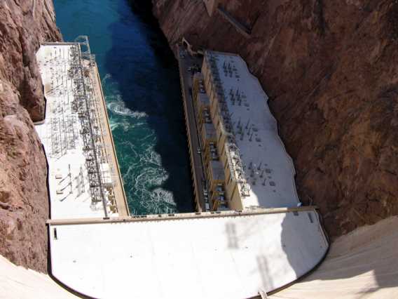
Back on top of the dam, here's a look down at the powerhouse and canyon over 700 feet below.
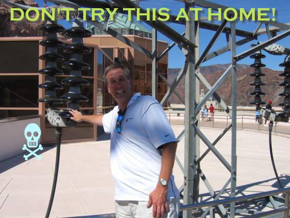
Time to recharge the batteries? Here I am grabbing an insulator, like the ones on the steel electrical tranmission towers here.
For more information on Hoover Dam, visit the Dept. of the Interior's Official Site.
For more about the Hoover Dam Bypass project, which will put a new bridge over the Colorado River just 1500 feet downstream of Hoover Dam, visit www.hooverdambypass.org.
Click to go to the next page, Bryce National Park.
All content ©2006 Jeff Baker.us All Rights Reserved.