Mt. Greylock - Adams, Massachusetts - April 2011
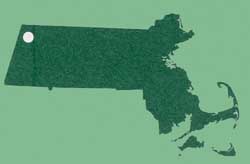
At 3,491 feet, Mt. Greylock is the highest point in the state of Massachusetts. The whale-like shape of the mountain was supposedly Herman Melville's visual inspiration for his novel 'Moby Dick'. He could see the mountain from his home in nearby Pittsfield, MA.
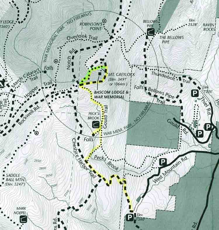
For this hike, we parked at the end of
West Mountain Road, elevation 1,560 feet. After about 1-1/2 miles on the Cheshire Harbor Trail, we turned right onto the 1/4-mile Peck's Brook Loop cut-off trail,
and met up with the Gould Trail. We paid a visit to the Peck's Brook shelter, one of 5 shelters within the Mt. Greylock State Reservation, then resumed our climb on the Gould. Another 0.6 mile later, we hit Rockwell Road, a paved seasonal road which was still a few days away from re-opening.
When open, you can drive up to the top from the southern side of the park, and that's the easy way to climb Mt. Greylock. But in April, that's not an option. We could have just walked the last half mile to the top on Rockwell Road, but instead we made the final ascent on the ice-covered Appalachian Trail. Lots of fun!
The AT comes out of the woods right next to a radio tower just below the Greylock summit. The site is home to WAMC-FM, Albany, NY (90.3) and 2 TV stations, WCDC-TV (channel 36) and W38DL (channel 38), both licensed to Adams, MA.
A few hundred yards away, on the summit, is the Veterans War Memorial Tower.
Here's the map of the hike. Our route marked in yellow, except for the Appalachian Trail, which is in green, and then, the pictures:
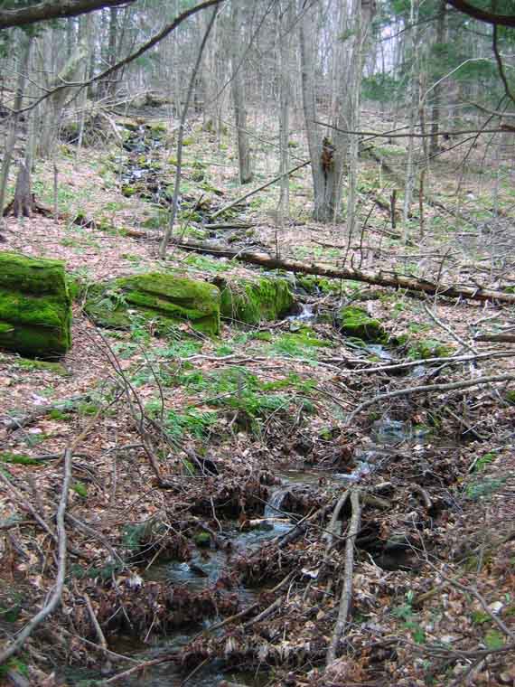
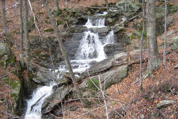
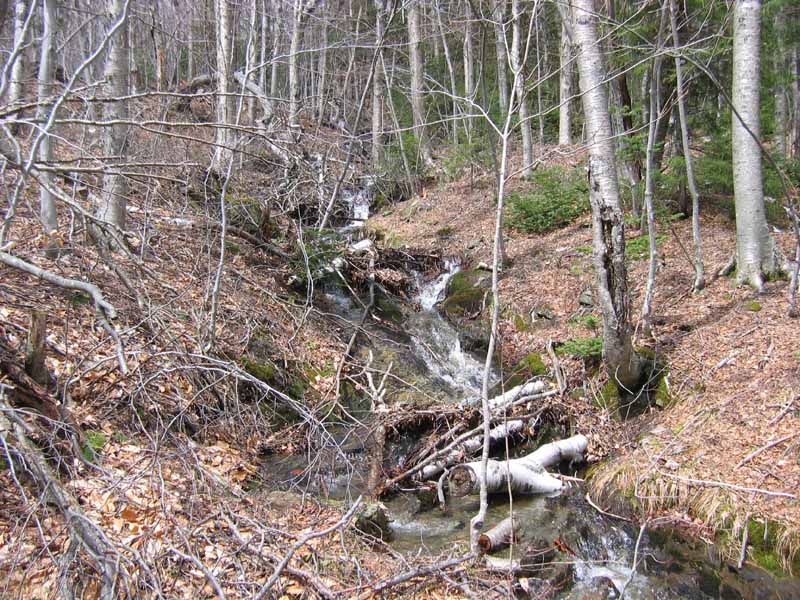
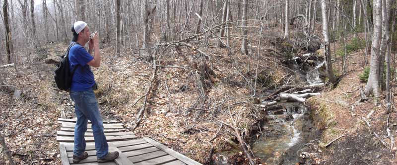
Lots of spring runoff in the pictures above. Sometimes the runoff ran on the trail, which required us to detour a bit.
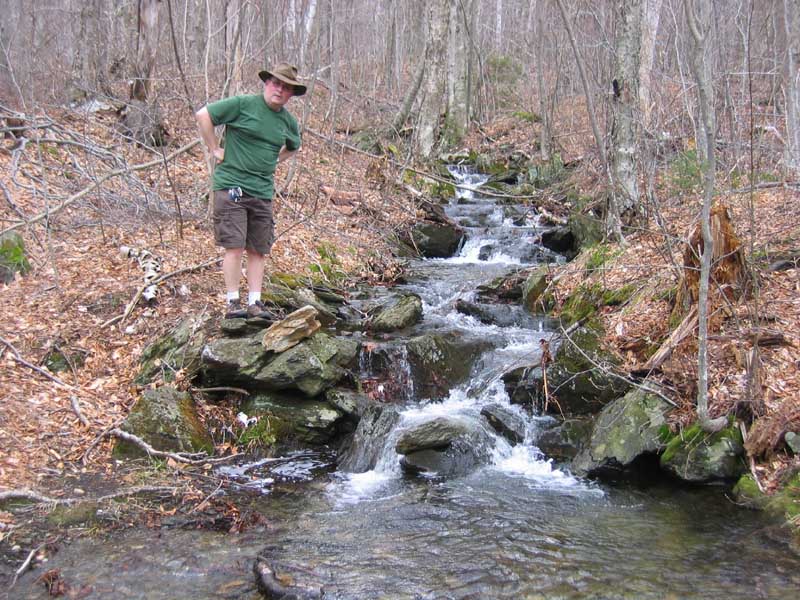
Below, a footbridge near the top of the Gould Trail that looks like it's seen better days, but was actually in pretty good shape.
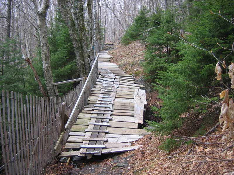
The footbridge (above) crosses this brook (below), probably Peck's Brook.
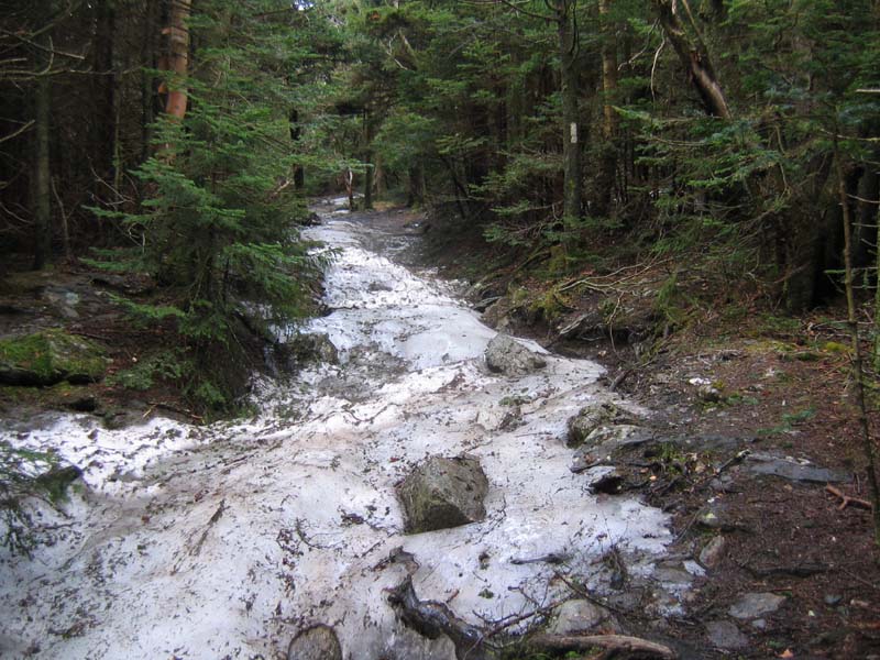
Above, the iced-up Appalachian Trail, here in late April, near the top of Mt. Greylock. See the white blaze on the tree at the right?
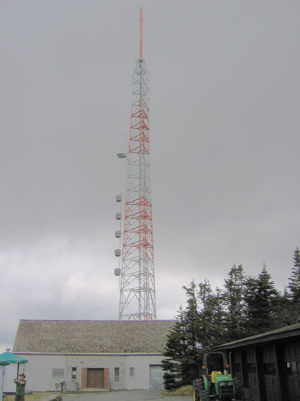
In the above photo, L to R, are a couple of green-roofed composting toilets, which are tied down so they won't blow away (the horror!!), Dr. Bill taking a picture, the transmitter building for WCDC-TV, W38DL(TV) and WAMC-FM, the 200' tower that hosts the antennas for those stations, a John Deere tractor, and a multi-bay garage structure.
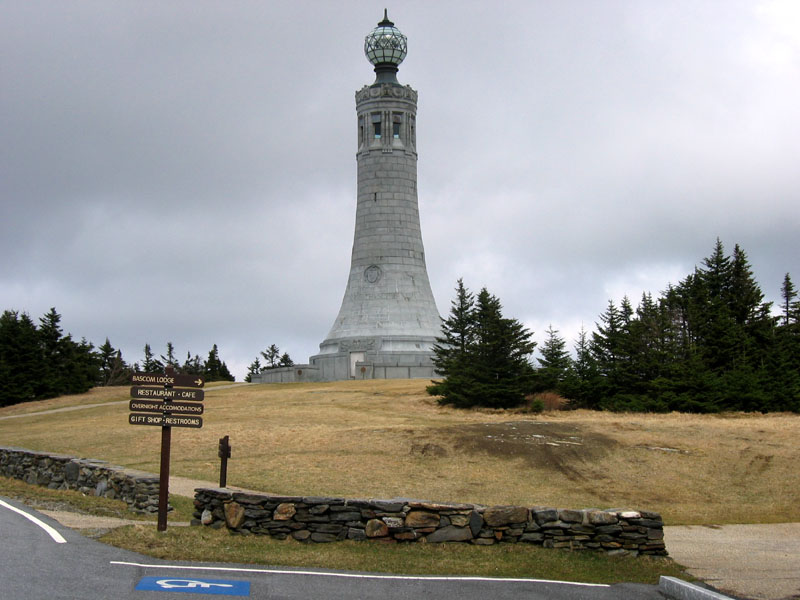
This is the 93-foot tall Veteran's Memorial Tower. Dedicated in 1933, they say the light that illuminates the top of the memorial can be seen for 70 miles.
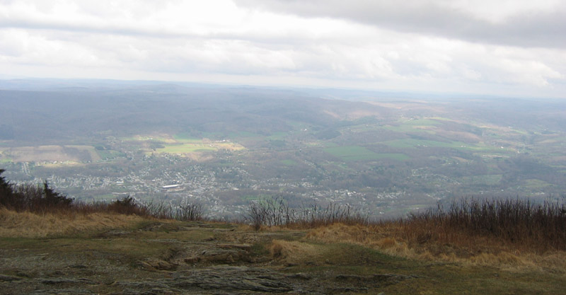
The view southeast from just beyond the Memorial. If you think it looks like rain, you're right. A few minutes after this picture was taken, we got rained on for a few minutes.
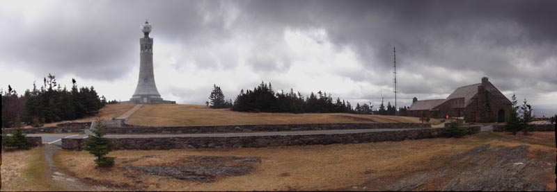
Here's a panoramic shot up top, showing the tower and the Bascom Lodge, a stone and wood structure built in the 1930's. Yes, it too was closed for our visit!
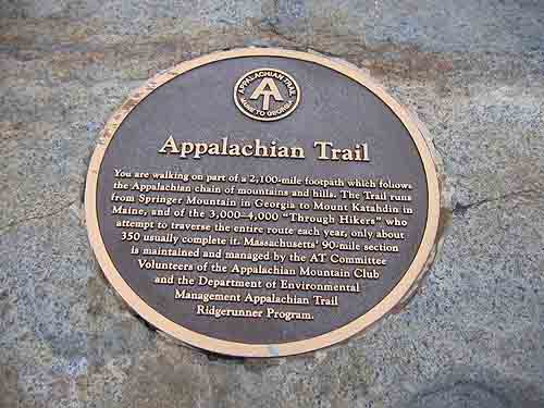
This is a plaque set into a rock wall near the Memorial Tower. Read all about the Appalachian Trail, which passes through here.

As we started down, rather than slippin' & slidin' on the App. trail, we walked about a quarter mile down Rockwell Road, passing this welcome sign.
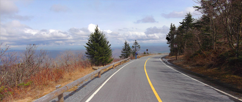
Following the brief shower up top, the weather cleared a bit. Here's the view looking out from our descent on Rockwell Road, before we turned onto the Gould trail.
Total time for this hike was about 5-1/2 hours.
Additional photos courtesy of The Doctor.
Maps from the Massachusetts Department of Conservation & Recreation reproduced here are done so under the terms and provisions of "Fair Use" in accordance with Title 17, Section 107 of the United States Code.
©2011 www.jeffbaker.us